
Mt. Kilimanjaro Lemosho Route 8 Days Itinerary
 with
with 

The 8 day Lemosho route is highly recommended and used by most prominent Kilimanjaro operators. On the 8 day Lemosho route, the trek from Barranco to Barafu is broken up into two days, allowing for a short day just prior to the summit attempt. This is important because summit day begins very early, around midnight, so climbers are sleep-deprived going into the toughest day on the mountain. By having a short day beforehand, climbers can be better rested.
Day 1
Londorossi Gate ─BigTreeCamp
6 km, ↑ 395m / 1296ft
Hiking Time: 3-4 hours
Habitat: Rain Forest
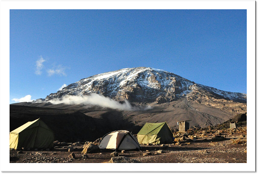
We depart Arusha to Londorossi Gate, which takes about 4 hours, where you will complete entry formalities and eat lunch. Then drive to the Lemosho trailhead (another hour). Upon arrival at the trailhead, we then start walking through undisturbed forest which winds to the first camp site (2780m / 9121ft).
Day 2
Big Tree Camp ─ Shira 1 Camp
8 km, ↑ 720m / 2362ft
Hiking Time: 5-6 hours
Habitat: Moorland zone
Continuing on the trail leading out of the forest and into a savannah of tall grasses, heather, and volcanic rock draped with lichen beards. As we ascend through the lush rolling hills and cross several streams, we reach the Shira Ridge before dropping gently down to
Shira 1 camp (3500m / 11483ft). The view of Kibo from across the plateau is amazing.
Day 3
Shira 1 Camp ─ Shira 2 Camp
14 km, ↑ 400m / 1312ft
or Moir Hut Camp
↑ 675m / 2215ft
Hiking Time: 5-7 hours
Habitat: Moorland
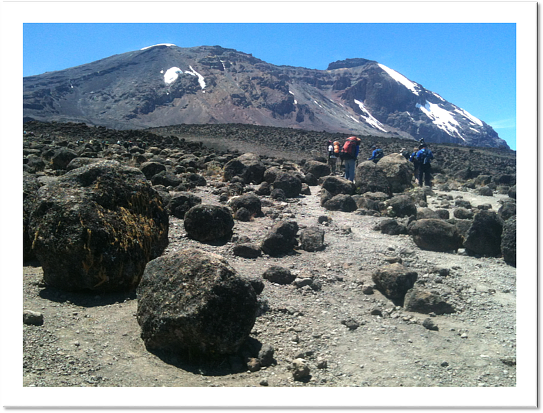
We explore the Shira plateau for a full day. It is a gentle walk east toward Kibo’s glaciered peak, across the plateau which leads to Shira 2 camp (3900m / 12795ft) on moorland zone!
After reaching to camp you can have lunch and later afternoon have a short walk for acclimatization
OR
Then we continue to Moir Hut (4175m / 13698ft),
a little used site on the base of Lent Hills. A variety of walks are available on Lent Hills making this an excellent acclimatization opportunity. Shira is one of the highest plateaus on earth.
Day 4
Shira 2 Camp (3900m / 12795ft) or Moir Hut (4175m / 13698ft) ─ Lava Tower ─ Barranco Camp (3960m / 12992ft)
Distance: 9 km from Shira 2 Camp or 7 km from Moir Hut Camp
Hiking Time: 7-9 hours from Shira 2 Camp or 4-6 hours from Moir Hut
Habitat: Semi Desert
From the Shira Plateau, we continue to the east up a ridge, passing the junction towards the peak of Kibo. As we continue, our direction changes to the South East towards the
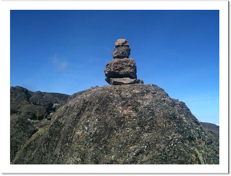
Lava Tower, called the „Shark‘s Tooth“
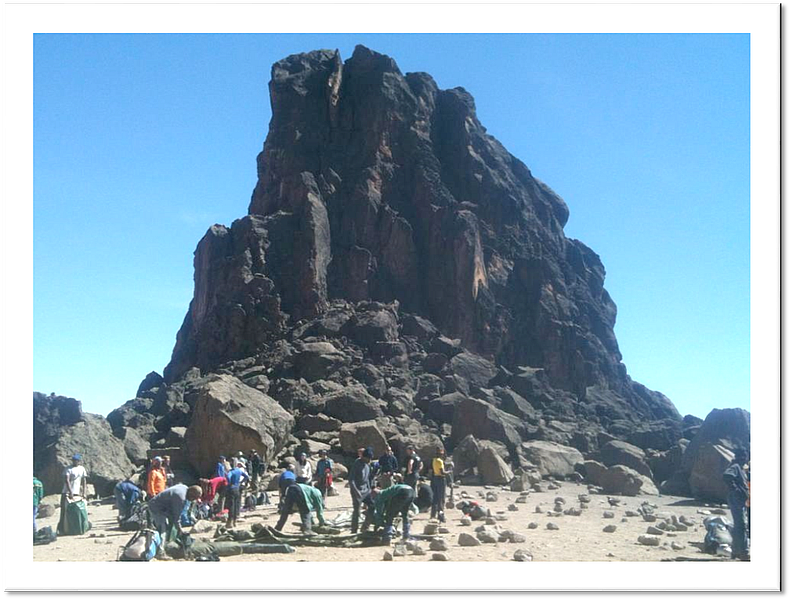
Shortly after the tower, we come to the second junction which brings us up to the Lava tower at an altitude of 4600m / 15092ft. We now continue downwards to the Barranco Hut at an altitude of 3960m / 12992ft. Just here we rest, enjoy dinner, and overnight. Although you end the day at the same elevation as when you started, this day is very important for acclimatization and will help your body prepare for summit day.
Day 5
Barranco Camp ─ Karanga Camp
6km, ↑ 375m / 1230ft, ↓300m / 984ft
Elevation: 3960m / 12992ft to 4035m / 13238ft Distance: 5km
Hiking Time: 4-5 hours
Habitat: Alpine Desert
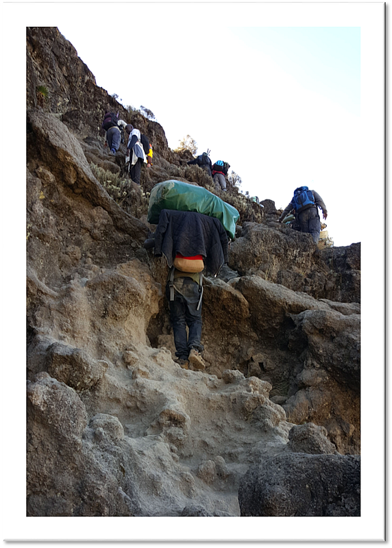
After breakfast, we leave Barranco and continue on a steep ridge passing the Barranco Wall to the Karanga Valley campsite. This is a short day meant for acclimatization.
Day 6
Karanga Camp ─ Barafu Camp
4 km, ↑ 605m / 1985ft/h4>
Hiking Time: 4-5 hours
Habitat:Alpine Desert
After breakfast, we leave Karanga, the junction which connects with the Mweka Trail. We continue up to the Barafu Hut (4640m / 15223ft). At this point, you have completed the South Circuit, which offers views of the summit from different angles. Here we make camp, rest, enjoy dinner, and prepare for the summit day. The two peaks of Mawenzi and Kibo are to be seen from this position.
Day 7
Barafu Camp -- Summit -- Mweka Camp
↑ 1255m / 4117ft, ↓ 2815m / 9236ft
Distance: 5 km ascent / 12 km descent
Hiking Time: 7-8 hours ascent / 4-6 hours descent
Habitat: Arctic
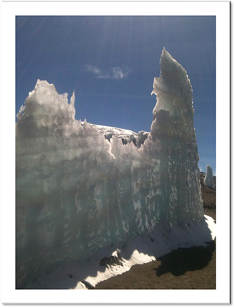
Very early in the morning (mid- night to 2am), we continue our way to the summit between the Rebmann and Ratzel glaciers. You head in a north-westerly direction and ascend through heavy scree towards Stella Point on the crater rim. This is the most mentally and physically challenging portion of the trek.
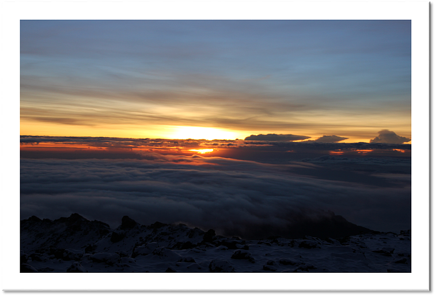
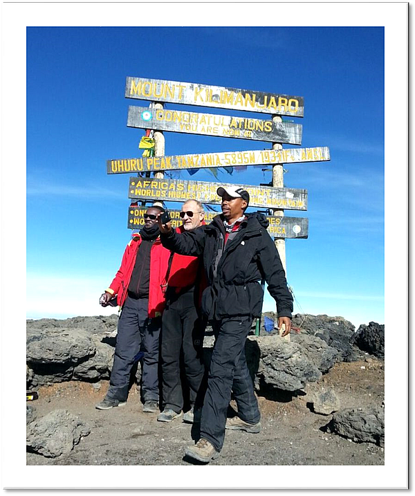
At Stella Point (5730m / 18799ft), you will stop for a short rest and will be rewarded with the most magnificent sunrise you are ever likely to see (weather permitting). From Stella Point, you may encounter snow all that way on your 1-hour ascent to the summit. At Uhuru Peak, you have reached the highest point on Mount Kilimanjaro and the continent of Africa. Faster hikers will see the sunrise from the summit.
From the summit, we now make our descent continuing straight down to the Mweka Hut camp site, stopping at Barafu for lunch. You will want gaiters and trekking poles for the loose gravel going down.
Mweka Camp 3080m / 10105ft)
is situated in the upper forest and mist or rain can be expected in the late afternoon. Later in the evening, we enjoy our last dinner on the mountain and a well-earned sleep.
Day 8
Mweka Camp -- Mweka Gate
6km, ↓ 1450m / 4757ft
Hiking Time: 3-4 hours
Habitat: Rain Forest
After breakfast, we continue the descent down to the Mweka Park Gate to receive your summit certificates. At lower elevations, it can be wet and muddy. Gaiters and trekking poles will help. Shorts and t-shirts will probably be plenty to wear but don’t forget to keep rain gears with you!
From the gate, you drive two hours to the hotel in Arusha.